Weekend Champion

Chasing your passions, one weekend at a time

Alliance, NE


1 Comment

Along The Way: Carhenge

On a lonely highway in western Nebraska (just north of the town of Alliance), you can find a place unlike anywhere else in the western hemisphere. The pictures will speak for themselves, but at Carhenge you will find a replica of Stonehenge made from junk cars. The artist (Jim Reinders) dedicated the site in 1987. There is no admission charge.

OLYMPUS DIGITAL CAMERA OLYMPUS DIGITAL CAMERA OLYMPUS DIGITAL CAMERAOLYMPUS DIGITAL CAMERAOLYMPUS DIGITAL CAMERAOLYMPUS DIGITAL CAMERAOLYMPUS DIGITAL CAMERAOLYMPUS DIGITAL CAMERAOLYMPUS DIGITAL CAMERAOLYMPUS DIGITAL CAMERAOLYMPUS DIGITAL CAMERA


1 Comment

Along The Way: The Center of the Nation

Prior to my trip in Rapid City, I was on a quest to find things in-and-around the area to do. As a lifelong geography-nerd, I knew the geographic center of the Nation was in western South Dakota. I thought that it may be fun to visit the site and snap a few pictures of whatever tourist-trap roadside attraction had been built there. So, I started my online research. Much to my surprise, the site was barely honored at all. I discovered the most fascinating article regarding the site’s history. It made my desire to visit the site even greater.

I had considered re-writing my own version of the significance of the Center of the Nation site, but I would hardly be as masterful as Dan Barry has provided. Therefore, I ask you all to read his New York Times article “In The Middle of Nowhere, a Nation’s Center” (http://www.nytimes.com/2008/06/02/us/02land.html). Once you’ve read this article, my subsequent words may be more interesting.

———————————————————————————————————————

I began to question myself. “Is this really a good idea?” It had been miles since I had seen another vehicle. I was alone. No one knew where I was going, and I was on a gravel road driving away from civilization. I was in the heart of rattlesnake country, and at least twelve miles from the closest town. I had turned off of Highway 85, and on to this gravel road that softly crested the open prairie. I was supposed to continue on the gravel road for seven miles, but as I continued farther, it seemed like fifteen. Doubt seeped into my mind, “Is this really worth it?”; “Have I gone too far, and just missed it?”. My cell phone didn’t have reception, and I was unsure what I would do if my car broke down. It was hot, I didn’t have water, and I was a few hours of hiking away from the highway. I resisted the inner-panic and decided to carry on, even farther into the oblivion of the South Dakota prairie.

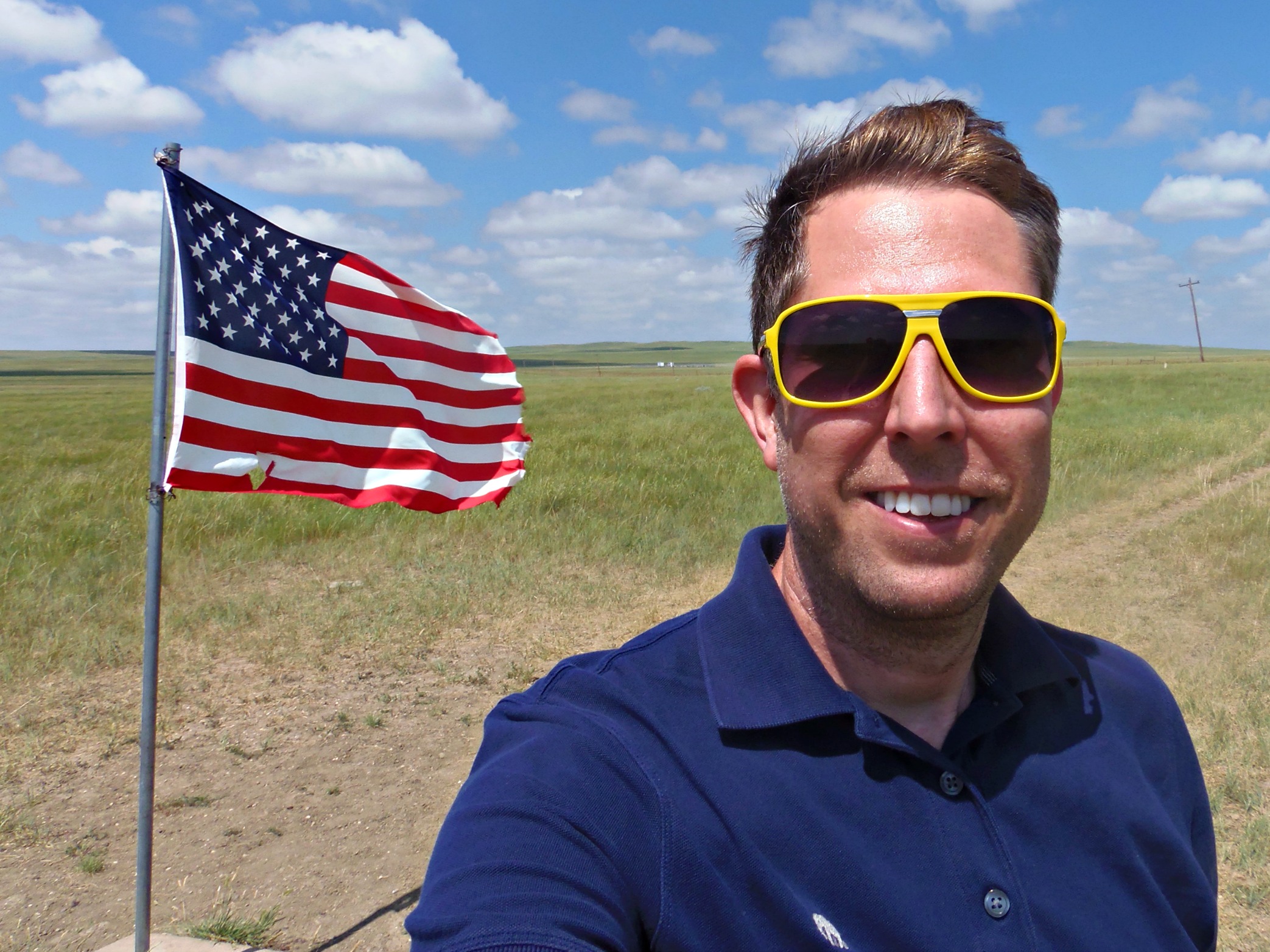
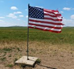
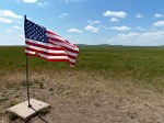
I approached another small crest in the rolling prairie hills, when something caught my attention off in the distance. A glimmer of red appeared amongst the fields of gold before me. Suddenly, my faith in the journey had been restored. I rolled on closer; and the blue corner with white stars and stripes became visible. Here I was! Deep in the heart of America, I made my way to a place that most people never think of visiting… The Center of the Nation!

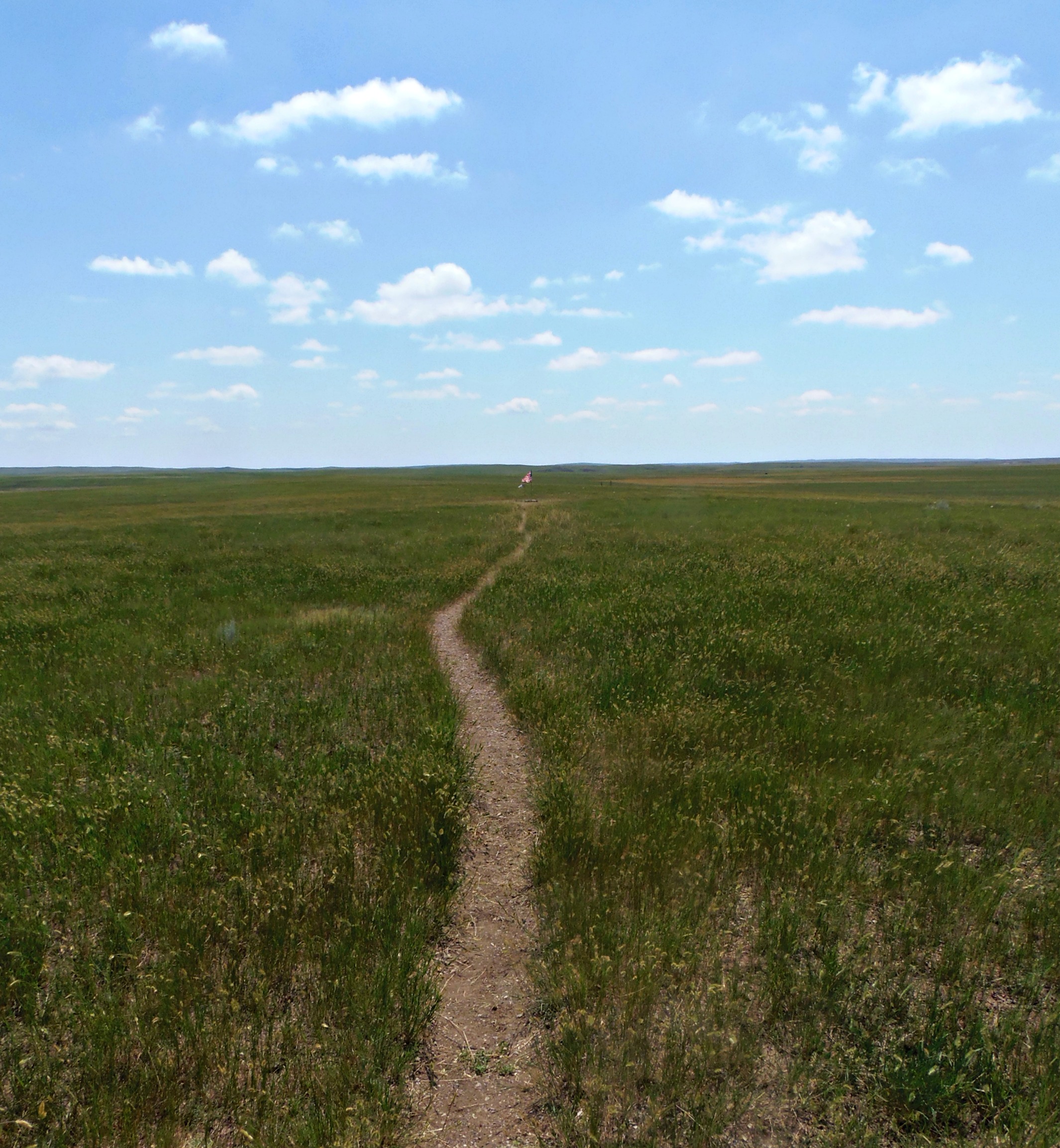
I parked my car in front of the small, hand-painted sign. The only thing that stood between me and my goal was a small barbed-wire fence. It took me a few minutes to determine how to contort my body through the fence without ripping my clothes, but the task turned out to be far easier than I had expected. Once I made it to the other side of the fence, I walked a small footpath for about 30 yards through the prairie.

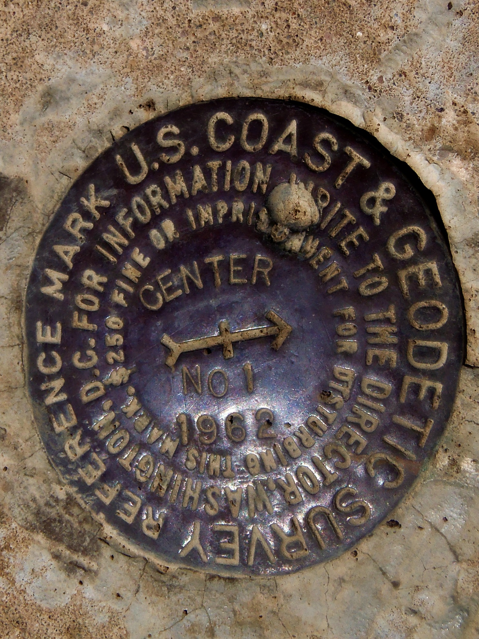
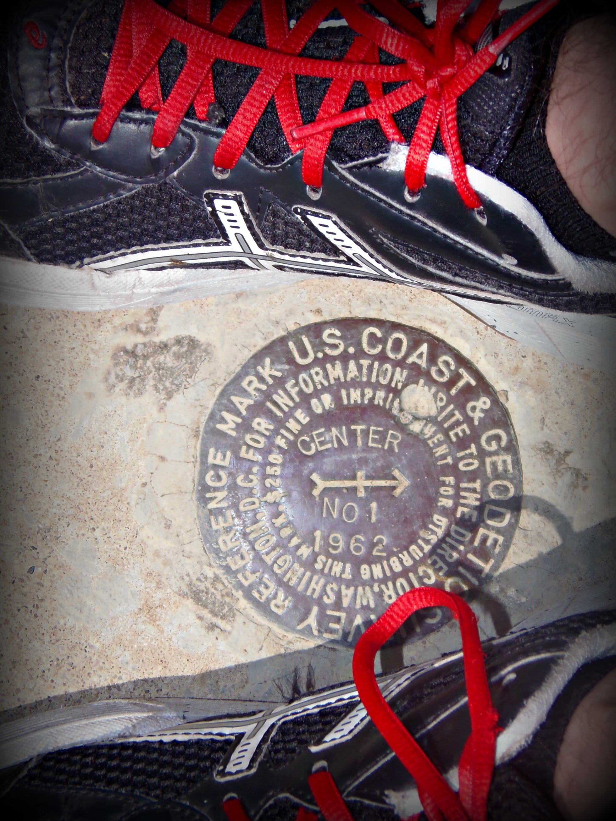
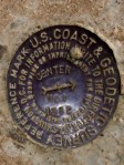
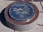
As I approached on foot, I was a bit surprised by the overwhelming sense of patriotism that took over. I had seen the American flag countless other times, but never once before had a wind-battered flag produced such profound emotion. At the base of the flag, was a small marker to denote the geographic significance of where I stood. Over the course of the next ten minutes, I took more photographs of an American flag than I ever thought I would. I’ve included many of these shots for you.

OLYMPUS DIGITAL CAMERA  OLYMPUS DIGITAL CAMERA  OLYMPUS DIGITAL CAMERA  OLYMPUS DIGITAL CAMERA

OLYMPUS DIGITAL CAMERA  OLYMPUS DIGITAL CAMERA  OLYMPUS DIGITAL CAMERA OLYMPUS DIGITAL CAMERA

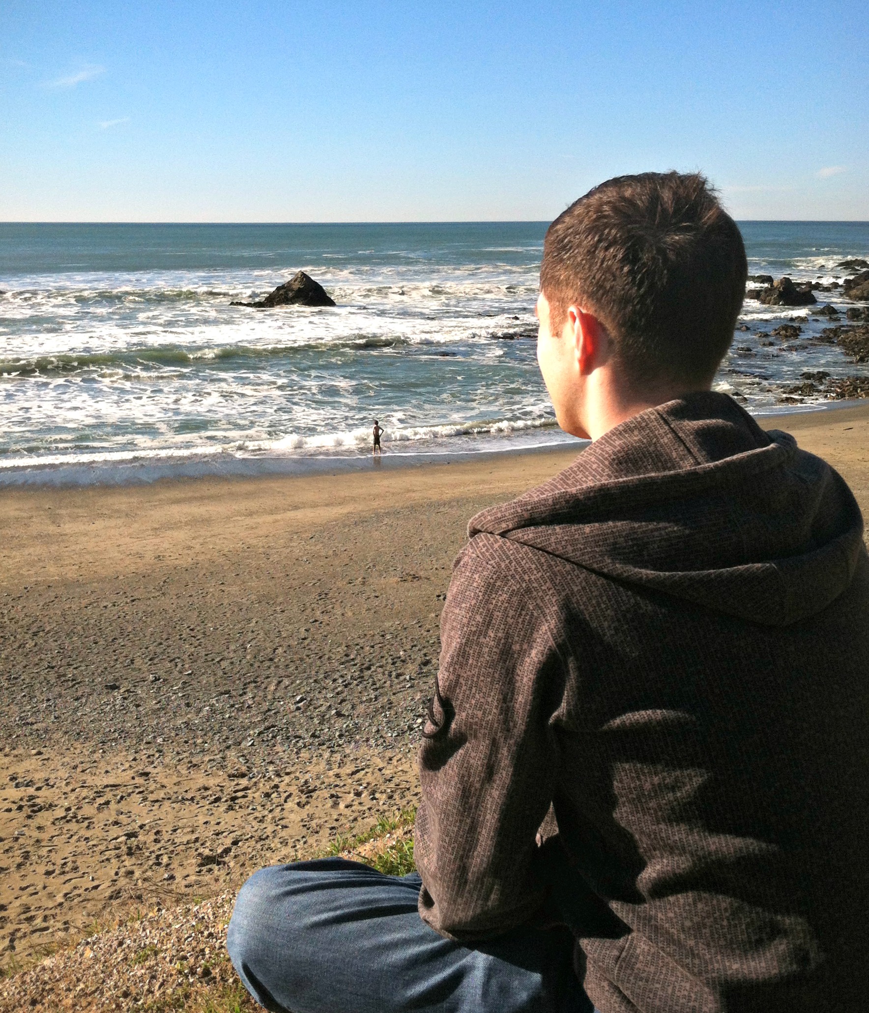
It’s hard to express in words, but this adventure was truly meaningful to me. I’ve spent my life loving geography… particularly loving American geography. I could name the 50 states before I started kindergarten. I’ve made it my life goal to explore as many acres of our great nation as I can; and here I was smack-dab in the middle of it all.

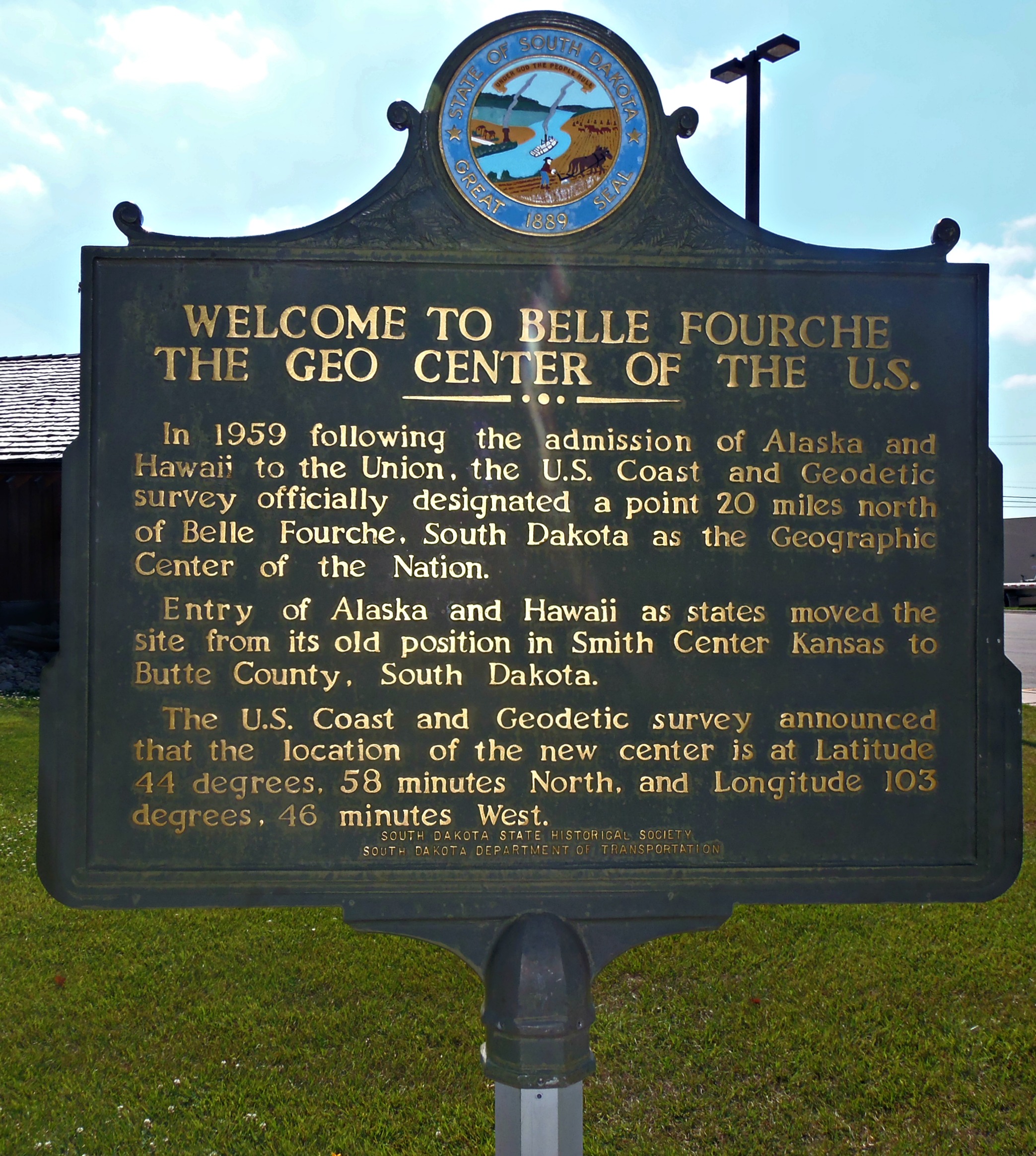
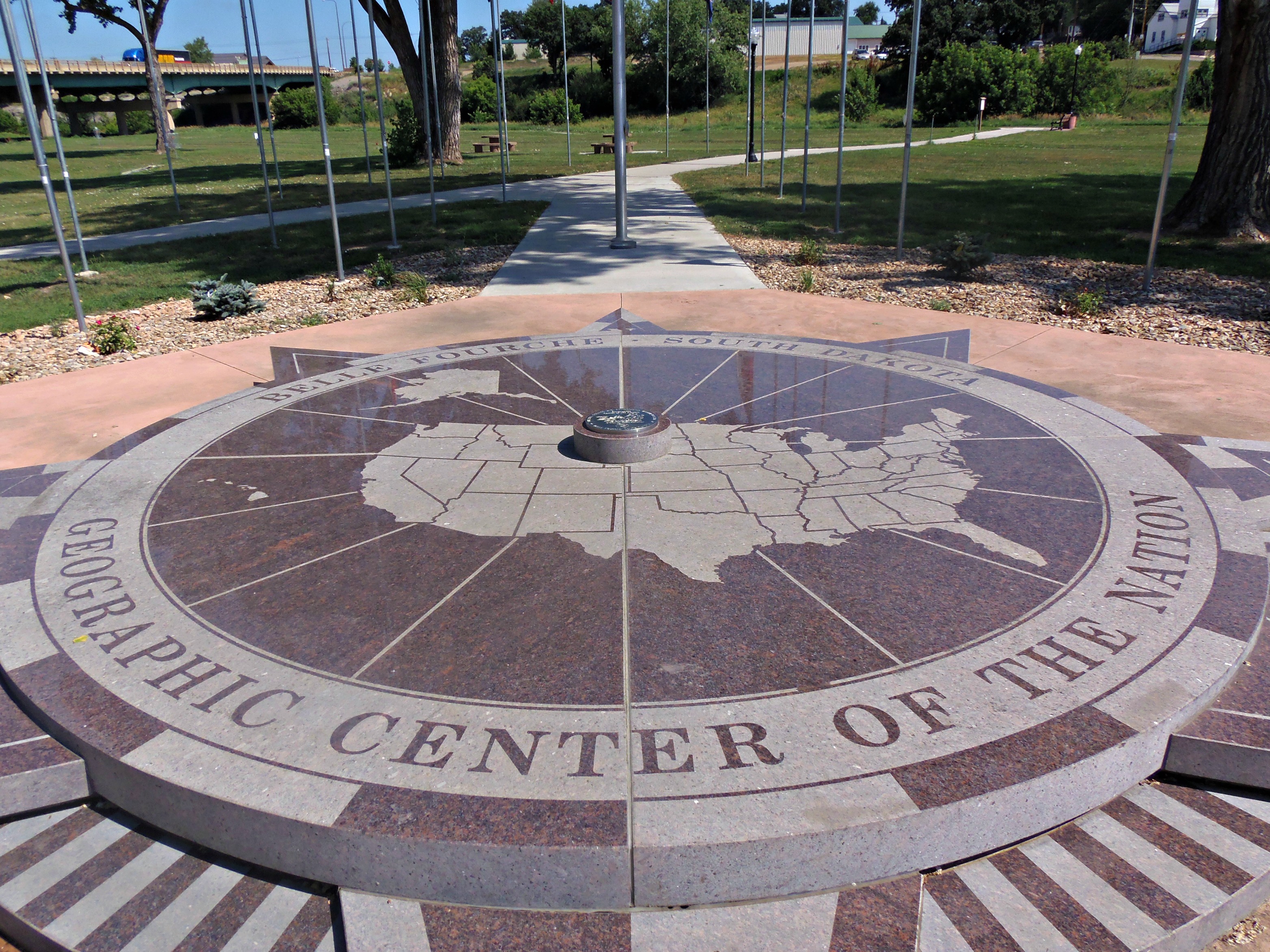
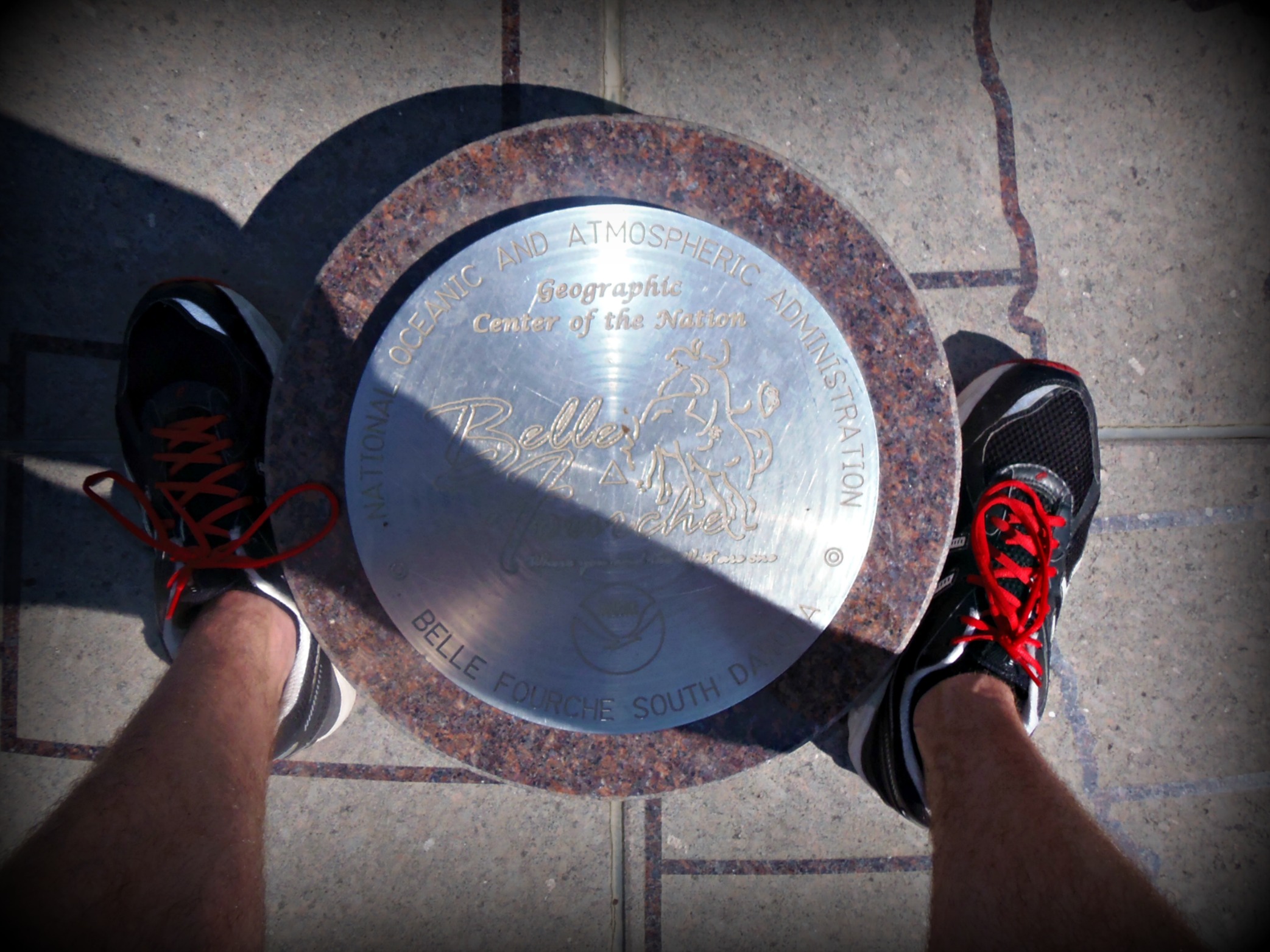
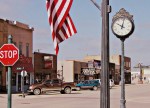
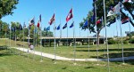
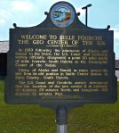
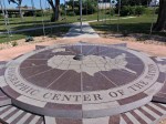
Re-energized, I headed back south to the closest town of Belle Fourche, South Dakota. This small community calls itself “The Centermost Town in America”, and for cheaters, there is a much more elaborate Center of the Nation marker at the Town’s local museum. This display is more photo-friendly, and much easier to reach, but I do encourage anyone that decides to go… Make the effort to visit the True Center. It was incredibly rewarding.

Photos from the Belle Fourche center of the nation display:

OLYMPUS DIGITAL CAMERA  OLYMPUS DIGITAL CAMERA  OLYMPUS DIGITAL CAMERA    OLYMPUS DIGITAL CAMERA

OLYMPUS DIGITAL CAMERA  OLYMPUS DIGITAL CAMERA    OLYMPUS DIGITAL CAMERA  OLYMPUS DIGITAL CAMERA

You’ll need about an hour to get from Belle Fourche to the True Center. The gravel road wasn’t designed for high speeds. You may also opt to spend 20 minutes in Belle Fourche at the Center of the Nation Museum.


Leave a comment

Along the Way: Vore Buffalo Jump

If you’re in northeastern Wyoming and looking for an interesting one-hour stop along Interstate 90, the Vore Buffalo Jump (http://www.vorebuffalojump.org) offers the opportunity to explore a rather ingenious  hunting method used by Native Americans (specifically the Apache, Cheyenne, Crow, Hidatsa, Kiowa, and Shoshone).  The site will pique the interests of anyone with a flair for archaeology, history, Native American cultures, or hunting.

The modern story of the Vore Buffalo Jump all began in the 1970’s. Interstate 90 was under construction, when a sizable sinkhole was discovered at this site. Exploratory drilling took place to investigate the sinkhole, and through this process a multitude of buffalo skeletons were discovered. Shortly after this discovery, it was determined that generations of Native Americans had herded bison to this spot by frightening the animals. As the chase ensued, the bison would be rushed toward the hidden sinkhole and plummet to their deaths. The animals were then butchered at the site, and the skeletal remains were left behind to be discovered some 400 years later.

At the Vore site, you can walk down a path to the bottom of the sinkhole where you will find a temporary structure. Inside this structure, archaeologists work uncovering bones and bone fragments from the Earth.  You can also learn quite a bit about the process used in the Buffalo Jumps and browse a number of artifacts on display.

OLYMPUS DIGITAL CAMERA

Rating: Overall, the Vore Buffalo Jump receives a 4 star rating (out of 5), in the roadside stop category.  I estimate that the average person would enjoy spending 30-60 minutes here.

The Vore Buffalo Jump is located near Beulah, Wyoming along Interstate 90. The site is just east of Sundance, Wyoming (close to the South Dakota border)


Leave a comment

Along The Way: Chimney Rock National Historic Site

On my recent drive (from Fort Collins, Colorado to Rapid City, South Dakota), I stopped in the small town of Bayard, Nebraska. Here that you’ll find one of Nebraska’s most iconic landscapes – Chimney Rock. Chimney Rock served as an important landmark for westward travelers in the 19th and early 20th centuries, because it rises approximately 300 feet above the landscape . Just a few miles north of the rock, you’ll find the Oregon Trail, California Trail, and Mormon Trail. It is said that Chimney Rock was the most referenced landmark in the writings of these brave pioneers. You may ask yourself just how important is this landmark in the hearts and minds of Nebraskans today? In 2006, Nebraska’s State Quarter was released and featured Chimney Rock. You’ll even find the landmark on Nebraska’s welcome signs.

To protect the eroding rock formation, travelers are not allowed on the rock. It is best to visit the headquarters for the Chimney Rock National Historic Site (Chimney Rock Rd, Bayard). The headquarters will feature incredible views and an interesting museum about the area’s history and the pioneer’s way of life. The area has multiple signs warning visitors to watch out for rattlesnakes. I didn’t see one, but it added to my sense of adventure! You’ll only need 30-60 minutes to fully experience the site, making it a perfect pit-stop along the way.

Side note: Just north of Chimney Rock (along Hwy 26), you can see the Oregon Trail. There’s a sign, and makes for a pretty good photo opportunity for anyone who was a kid in the ’80s, and loved the game.

OLYMPUS DIGITAL CAMERA OLYMPUS DIGITAL CAMERA OLYMPUS DIGITAL CAMERA OLYMPUS DIGITAL CAMERA

RATING: I give Chimney Rock a 4 star rating (out of 5) for the Roadside Attraction category. I estimate that the average person would want to spend 30-60 minutes here.

When travelling by car, I like to find landmarks along the way. Oftentimes, these pit stops are opportunities to discover unusual or interesting places that might not have enough wow-factor to keep you entertained for a full weekend. These brief stories will be featured in our “Along The Way” section of our website.  For your next road trip, check out this section, and find some side-adventures of your own.